Companion to the Ireland: Fact or Folklore YouTube episode
A tower, a vanished fort, a woman remembered in stone and creatures whose tracks outlived them by millions of years. The Cliffs of Moher hold more stories than one photograph can show.
This companion explores the evidence behind the landscape, the people who worked and welcomed visitors here, and the legends that gave the coast another kind of life. Some stories can be checked in rock or historical records. Others belong to folklore, where a place can carry a memory without proving that the event happened.
Where the cliffs meet the Atlantic
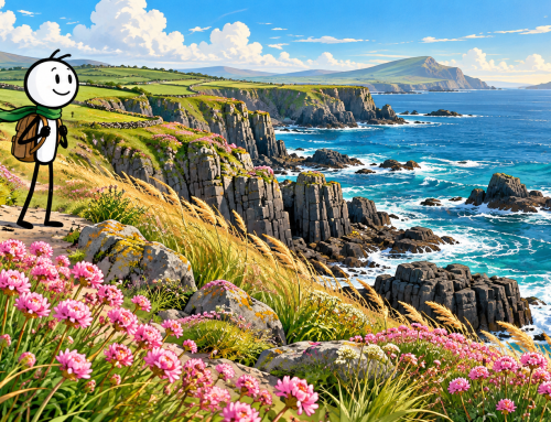
The Cliffs of Moher stand on the west coast of County Clare, near Liscannor. The visitor attraction describes the cliff line as approximately 8 kilometres (5 miles) long in a straight line, reaching 214 metres (702 feet) at its highest point. That length describes the landscape, rather than an open walking route. [1]
The view draws your attention out to sea. Try looking back at the rock as well. Those horizontal bands tell a story that began long before anyone built a tower or told a tale about this coast.
The ancient river hidden in the rock
Around 320 million years ago, during the Carboniferous Period, rivers carried sand, silt and mud towards an ancient sea. Sediment accumulated in a delta and was eventually buried and turned into rock. The land that would become this part of Ireland was then near the equator. [2, 3]
The cliff face contains sandstone, siltstone and shale. Different layers resist erosion differently, helping to produce the stepped ledges you can see today. Fractures also influence how blocks break away. The rocks are ancient, but today’s exposed cliff face is the much later result of erosion. It would be misleading to say the cliffs have looked like this for 320 million years. [2]
There is a smaller mystery underfoot. Some Liscannor flagstones used around the visitor centre carry winding trace fossils: evidence of burrowing activity in ancient sediment. These preserve what an animal did, rather than necessarily preserving its body. The Geopark notes that the creatures responsible for these particular markings remain unidentified. [3]
A tiny trail can therefore hold a question that a huge cliff cannot answer. What made it, and what was life like in that vanished environment?
A name left by a vanished fort
Moher is linked to an earlier promontory fort at Hag’s Head, described by the visitor attraction as Mothar, or a ruined fort. Its history page records that the earlier structure was demolished for material when a signal tower was built in 1808 during the Napoleonic Wars. [1, 4]
This brings archaeology into the story, even where a visitor cannot see an intact ancient monument. A name can preserve the memory of a structure after its stones have been moved. The signal tower at Hag’s Head and O’Brien’s Tower are different buildings, with different purposes. [4, 5]
The people behind the postcard
Cornelius O’Brien, a local landowner and MP, built O’Brien’s Tower in 1835 as an observation point for visitors. Its place in early tourism is documented; colourful explanations about impressing potential sweethearts should be treated as stories rather than established motives. [5]
The cliffs also supported working lives. The attraction’s history account describes a local flagstone industry that supplied building stone overseas, including to London and Liverpool. Quarry workers and the port at Liscannor belong in this landscape’s history alongside the visitors admiring it. [4]
Another recorded local figure was Denis, or Dinny, McMahon. In the late 1950s he began guiding visitors, sharing his knowledge of wildlife, rock formations and local stories, and playing the tin whistle. His work reminds us that a place is often understood through the people who explain it. [4]
When you look at the cliffs, picture the labour of extracting stone, the skill of reading the weather and the conversation between a guide and someone seeing the Atlantic coast for the first time.
Mal and the shape of Hag’s Head
In a legend retold by the Cliffs of Moher visitor attraction, a woman named Mal pursues the warrior Cú Chulainn. Their chase reaches the coast, where he escapes through extraordinary leaps. Mal tries to follow, falls, and becomes associated with the rock profile at Hag’s Head. [6]
This is folklore, not a verified account of the headland’s formation. Its interest lies in the way a recognisable shape becomes a character, and a dangerous coast becomes a setting for pursuit and tragedy.
The mermaid who found her way home
Another local legend tells of a fisherman who hides a mermaid’s magical cloak, preventing her return to the sea. She remains on land, marries him and has children. Years later, she finds the cloak and leaves for the ocean. [6]
Read today, the tale invites a question about freedom: is a home still a home if someone cannot leave? That is an interpretation of the story, rather than proof of what its earliest tellers intended. Like other traditional tales, versions can differ.
The city beneath the waves
The Kilstiffen legend imagines a submerged city awaiting the return of a lost golden key. Some versions say it reappears every seven years. This is another story recorded by the visitor attraction, rather than evidence of an excavated town. [6]
What makes it memorable is the ordinary object at its centre. A missing key can lock you out of a house; here, it keeps an entire city out of reach. That is a reading of the tale, not a claim about its origins.
Wildlife worth slowing down for
The cliffs are a Special Protection Area for birds. The National Parks and Wildlife Service lists fulmar, kittiwake, guillemot, razorbill, puffin and chough among the site’s qualifying interests. These birds are part of the reason the landscape is protected. [7]
Puffins are a seasonal attraction, rather than a sight promised throughout the year. The visitor attraction recommends May and June for viewing them. Binoculars let you enjoy the colonies from designated viewing areas without moving closer to the edge. [8]
Look at ground level too. Sea pink, also called thrift, produces rounded pink flower heads above low cushions of leaves. The attraction’s wildflower guide gives its flowering period as April to July. Sea campion and bird’s-foot-trefoil are also recorded here. Observe plants where they grow and leave them for the next visitor. [9, 10]
Interesting details to look for
Start with a paving stone. A trace fossil is closer to a footprint than a skeleton: it records activity. You can know that something moved through sediment without knowing exactly which creature made the trail. Compare a winding marking with the straight edges made when the stone was cut. [3]
Then compare the towers. O’Brien’s Tower was built for viewing the scenery; the Hag’s Head signal tower belonged to a system of coastal communication. Similar positions above the sea served different needs. One helped people enjoy a view, while the other helped information travel. [4, 5]
Finally, ask what you notice first: the cliff face, the birds or the shape that inspired Mal’s story? Try choosing a different subject for your next photograph. A flower beside the path or a band of rock can tell a story that a wide landscape shot misses.
Planning a visit
Access information checked on 5 October 2026: the official coastal-walk notice, dated 1 August 2026, states that the southern route from Liscannor or Hag’s Head to the Cliffs of Moher Experience is closed. The northern walk from Doolin is open only as far as Surfers Path, with no through access to the Experience. Check the official notice again before travelling, because conditions and closures can change. Stay on designated paths and respect barriers. [11]
For visitors with limited mobility, the visitor centre is wheelchair accessible and staff-operated electric buggies are available subject to availability. Outdoor gradients vary, so ask the attraction about your particular needs before visiting. [12]
Bring a waterproof layer and give yourself time to pause. You do not need a long coastal walk to notice a bird colony, a fossil trace or the changing light across the rock.
Say the names with confidence
These are approximate English reading aids. Moher: MOH-er. Liscannor: lis-KAN-er. Doolin: DOO-lin. O’Brien: oh-BRY-en. Cú Chulainn: koo KULL-in. Local and Irish-language pronunciation can vary.
Which story will stay with you?
Perhaps it will be Mal’s pursuit, the mermaid’s escape, Dinny’s music or the unidentified creature that left a trail in the mud. Each encourages a different way of paying attention.
Watch the Cliffs of Moher episode of Ireland: Fact or Folklore, then tell us which detail changed the way you see this coast. Subscribe for more Irish stories, and explore the companion pieces here on Cosy in Ireland. There is always something else to notice when you look beyond the familiar view.
Sources and further reading
Sources checked on 5 October 2026. Numbered references distinguish evidence from legend; the folklore source records modern retellings rather than establishing that the events occurred.
1. Cliffs of Moher Experience — About the Cliffs of Moher
2. Cliffs of Moher Experience — Geology
3. Burren and Cliffs of Moher UNESCO Global Geopark — Cliffs of Moher geosite
4. Cliffs of Moher Experience — History
5. Cliffs of Moher Experience — O’Brien’s Tower
6. Cliffs of Moher Experience — Myths and Legends
7. National Parks and Wildlife Service — Cliffs of Moher SPA 004005
8. Cliffs of Moher Experience — Bird Watching
9. Cliffs of Moher Experience — The Wild Flowers of the Cliffs of Moher
10. Cliffs of Moher Experience — Easter at the Cliffs